-
 Explorer Chartbook Near Bahamas, 8th EditionThe Near Bahamas, the islands closest to Florida, provide a tropical cruising paradise just a short distance from mainland USA.The seventh edition of this popular chartbook includes what you, Bahamas cruisers, ask for -- detailed Gulf Stream Crossing routes plus small- and large-scale charts of the...$69.77
-
 Upper Chesapeake Bay MAPTECH® Waterproof Chartbook 1st EditionMAPTECH Upper Chesapeake Bay Waterproof Chartbook has 70 pages of full-color navigation charts covering Chesapeake and Delaware Bays. Includes the Delaware River to Philadelphia, the C&D Canal, and the Chesapeake Bay to Solomons Island including navigable tributaries. Features: Waterproof, Tear-resi...$79.00
-
Sale
 Intracoastal Waterway Chartbook Norfolk to Miami, 6th Edition (Intracoastal Waterway Chartbook: Norfolk, Virginia to Miami, Florida)$500 WORTH OF GOVERNMENT CHART AND COAST PILOT COVERAGE--MARKED WITH WAYPOINTS, BRIDGES, AND THE ROUTE! The Intracoastal Waterway Chartbook is a complete set of navigation charts for the 1,090-mile Intracoastal Waterway from Norfolk to Miami, as well as charts for all major Atlantic inlets. The char...$47.08$78.00
-
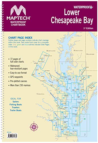 Maptech Lower Chesapeake Bay Waterproof Chartbook 1st EdMAPTECH Lower Chesapeake has 72 pages of full-color navigation charts covering Chesapeake Bay from Solomons Island south to Norfolk, VA. including The Potomac River and other navigable tributaries. Features Waterproof, tear-resistant pages and an easy-to-use format with many GPS Waypoints and pre-pl...$78.00